Sailing Lydia Down the Chesapeake Bay
by Gerald Todd
 In July 1980, my friend Mark Rooney and I sat in a South Baltimore sub shop and talked about the possibility of sailing his 16 foot sailboat, Lydia, to Norfolk, Virginia.
At some point we settled ourselves to do it and began gathering what we would need for the trip. We planned to sail by day, and anchor at night, travelling down the bay in four day long hops.
Leaving from Baltimore's Inner Harbor, we would sail first to Poplar Islands to spend the night. The second stop would be Solomon's, MD. Deltaville, Virginia would be the third, and the last
leg would end at Willowby Spit, in Norfolk, where we were living. We took what we thought was ample for a four day-four night trip plus a young tabby cat named Horatio.
In July 1980, my friend Mark Rooney and I sat in a South Baltimore sub shop and talked about the possibility of sailing his 16 foot sailboat, Lydia, to Norfolk, Virginia.
At some point we settled ourselves to do it and began gathering what we would need for the trip. We planned to sail by day, and anchor at night, travelling down the bay in four day long hops.
Leaving from Baltimore's Inner Harbor, we would sail first to Poplar Islands to spend the night. The second stop would be Solomon's, MD. Deltaville, Virginia would be the third, and the last
leg would end at Willowby Spit, in Norfolk, where we were living. We took what we thought was ample for a four day-four night trip plus a young tabby cat named Horatio.
The trip didn't exactly follow the plan. Instead of 4 days, it took us 18 days to finally reach Norfolk, 12 of which were spent in Solomons visiting and waiting for more Northerly winds. The trip ended with the boat anchored in the Poquoson River, just 20 miles sailing from Norfolk, and was eventually taken the rest of the way by trailer. Soon after, I returned to Baltimore, and later so did Mark. Lydia came back by trailer August 18th, 1981.
 Lydia is a WindSprite class day-sailor, 16 feet long, built by Eugene Kelly in Fells Point in 1977. She was the prototype for 15 later WindSprites that were eventually built and sold.
She carries about 150 square feet of sail in a Marconi sloop rig, and is built of fiberglass. She has a 10'cockpit with bench seats that run fore-and-aft along either side. There's a small
cuddy under her foredeck for storage and we carried a wooden tool-box aft between the seats that provided more storage and room for sleeping. Mark bought Lydia while he worked with Eugene
building the boats in August of 1978. We sat in Maria D's, the same sub shop mentioned above, one night and listed various names until we came up with Lydia. Lydia was the name of the
frigate commanded by Captain Horatio Hornblower in C.S. Forester's novels. Today, years later, I own Lydia, and Mark and I still sail her, although neither of us is planning so bold an
adventure for her.
Lydia is a WindSprite class day-sailor, 16 feet long, built by Eugene Kelly in Fells Point in 1977. She was the prototype for 15 later WindSprites that were eventually built and sold.
She carries about 150 square feet of sail in a Marconi sloop rig, and is built of fiberglass. She has a 10'cockpit with bench seats that run fore-and-aft along either side. There's a small
cuddy under her foredeck for storage and we carried a wooden tool-box aft between the seats that provided more storage and room for sleeping. Mark bought Lydia while he worked with Eugene
building the boats in August of 1978. We sat in Maria D's, the same sub shop mentioned above, one night and listed various names until we came up with Lydia. Lydia was the name of the
frigate commanded by Captain Horatio Hornblower in C.S. Forester's novels. Today, years later, I own Lydia, and Mark and I still sail her, although neither of us is planning so bold an
adventure for her.
What follows is a transcript of the "log" we kept during the trip, word for word. Reading it today, it sounds kind of melodramatic, but then again I was 19 and Mark was 16
and this was our big Tom Sawyer/Huck Finn adventure.
Log of the sloop Lydia. | |
|---|---|
| click a pic for a larger version | Wednesday, July 9th, 1980 0135 We are departing Baltimore from Bunker's house. All gear except stores and cat (Horatio) are on board. The weather is fair, the sky's clear and the wind's out of the North-West at approximately 10 miles-per-hour. We've said our good-byes and hope for a prosperous trip. The next entry will be under-way signed Mark S.Rooney Master |
 Leaving |
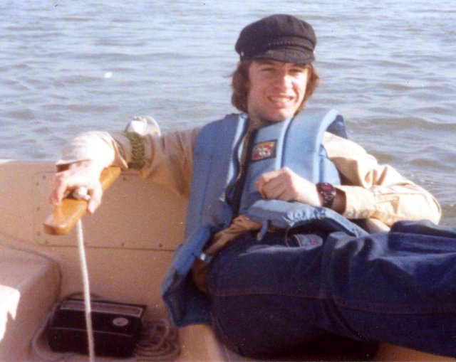
0245 We left the finger piers, Baltimore Inner Harbor, under reefed main and square. [the "square" was a blue, 6' x 8'tarp] On board are provisions and stores for four days sailing, Mark Rooney, myself, and one cat named Horatio Nelson Hornblower. 0307 0500 |
 Just before dawn |
0510 Jibbed main |
 Good Bye Baltimore |
0544 Passed under Key Bridge, running free. The cat's asleep. Good-bye Baltimore! |
 White Rocks |
0650 White Rocks on the starboard beam. 0723 |
 Bodkin Point |
0750 Came-about to clear Bodkin Point shoal marks 0800 0900 0940 1030 |
 Bay Bridges |
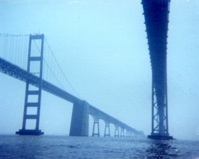
1100 Passed under Bay Bridges, moving towards the Eastern Shore. Will sail down Kent Island to Poplar Islands. 1200 1230 1245 |
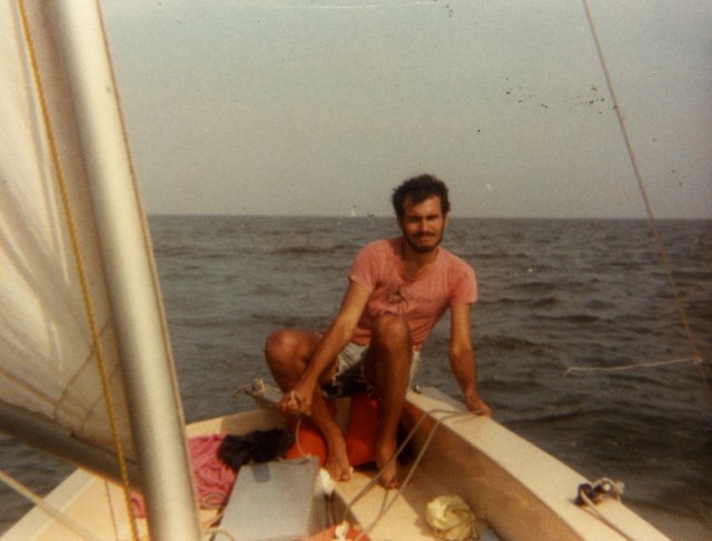 Jerry sailing to the Rhode River |
1630 After tacking to Curtis Point, we tacked again for a mile. We decided, after considering the weather situation, to come-about and reach back to the Rhode River to spend the night. The winds are South, to South-East at 15 mph. Lydia's showing main and jib. We have to repack and bail. The seas are picking up, 1 to 2 feet. 1800 c.2100 Thursday, July 10th 1300 1625 1826 2045 2115 2300 Friday, July 11th 0300 0330 0345 0400 0415 0500 0600 0624 0930 1015 1020 |
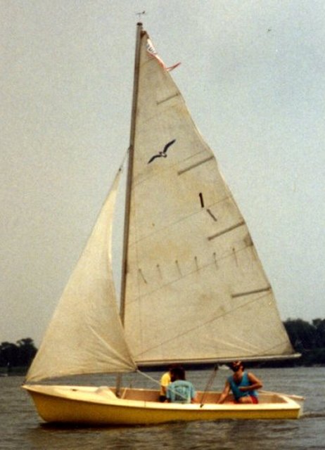
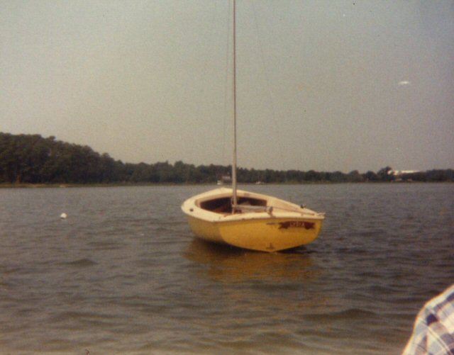
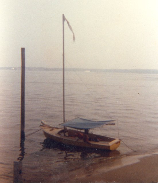 Lydia at Solomons Island |
1100 We made it! We landed at Solomons Island beside the "River and Estuaries Research" pier. Saturday, July 12th Comments: [Here's Mark being Captain John Smith] The shores are covered with Maple, Oak, Poplar, and Holly. I've also noticed a nice grade of pine that grows somewhat inland of the river and forms a belt around the shores. The weather is the only thing holding us up for the second part of our trip. As it goes now, we appreciate Dana and her mother's hospitality. It feels good to be out of the rain and thunder, and into warm beds. Our stop here in Solomons also gave Jerry and myself a chance to ease our minds of the constant concentration sailing a small boat on the bay requires, and of the constant exposure we've had, and will have to endure. We now feel more confident and composed to continue our trip. Signed Sunday, July 13th Tuesday, July 15th Comments: [Jerry] After a most pleasant stay at the Briscoe residence, it is time to leave. We could never be more thankful for they're having us. Jerry Todd 1100 1200 |
 Out and Back |
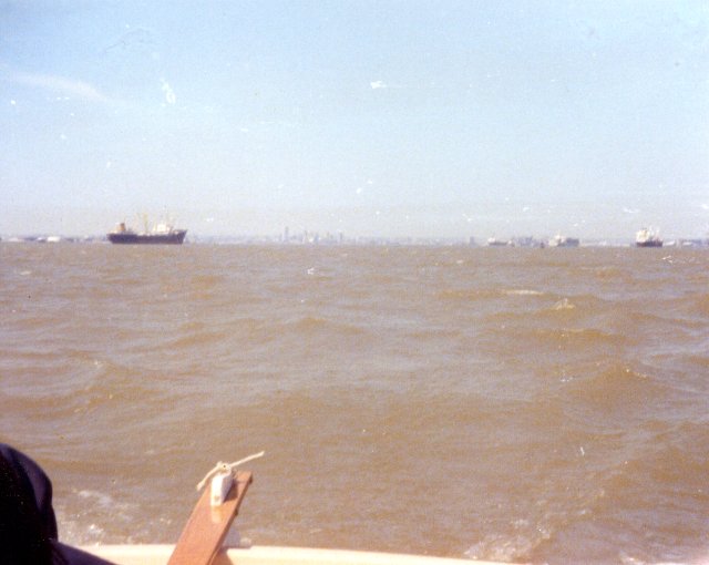
2000 Comments [Mark] We entered the bay with just the reefed main up. Seas were 4-5 feet with frequent rollers. Sailing about 110ø (just under due east). The seas seemed to be increasing as we were beating against them and a Southerly 20-25 mph wind. We were of Barren Island, West of Hoopers Straits, when we decided to try and anchor. We anchored off Barren Island's weather side about 1700. After considering the situation, we decided that even if the wind eased the sea would probably persist. The only safe harbor we could go to without giving up already gained mileage was Solomons. Anchored only 15 feet from the shore, we raised sail and anchor, and headed for Solomons on the other side of the bay. (A tricky maneuver we performed very well.) Heading back across, we were on a converging course with a tug-in-tow. We luffed the jib to slack our headway, fell in behind the barges, missing them by a few feet. The seas were off the quarter, and we were surfing down waves a boat-length apart and 5 feet high! Lydia was doing 10-12 knots on the average! For the amount of water hitting the foredeck, very little came inboard. Jerry was at the helm the whole time out and back. As we entered the Patuxent, we didn't mind the 2 foot chop at all! We anchored back at the research pier at about 1930. The weather tomorrow should be the same, according to the radio, so our stay is being made longer. Mark S.Rooney Wednesday, July 16th Friday, July 18th Sunday, July 20th Thursday, July 24th 0745 1130 0422 |
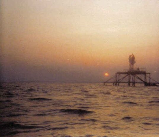 Windmill Point Light |
c.1130 After passing Windmill Point Light by about 50 yards at sunset, we passed Stingray Point light. It was already dark,and we were close enough to wake up what must have been at least a hundred seagulls! Later we came across a large ketch aground with no lights on at all expect interior lights. After a frustrating try to enter the channel; in which we almost hit a cable running between some net stakes right at water level; we came about to try again. Finally, we made the channel into Deltaville, Virginia. We are now anchored within 50 feet of day marker #10 just outside that channel. Friday, July 25th 0930 1200 Comments: [Mark] Comments: [Jerry] Saturday, July 26th |
 On the Poquoson |
1100 As it stands, the marina owner is allowing us to let Lydia stay anchored off the marina. We are going to sail or trailer her the rest of the way. Comments: [Mark] The people we met along the way who helped us, even when only a morale boost, represent what is definitely the most important thing we learned, humanity. Both Jerry and I want to thank the following people, because we couldn't have made it without our friends; Capt. Stevens D. Bunker, Baltimore, MD Sincerely, Mark S.Rooney and thank you Lydia for bringing us though! Addendum: |